
STEP 01
Drone broadcasts
Drones used in a SAR mission are required to broadcast ASTM F3411 Remote ID.
Managed coordination for SAR organizations
RID2Caltopo turns broadcast Remote ID into shared field awareness— helping search teams see drones, preserve coverage, and coordinate operations from Android, iPhone, and iPad.
Android is available on Google Play. Apple test invitations are provided by email while the latest release completes field testing.
The field link
STEP 01
Drones used in a SAR mission are required to broadcast ASTM F3411 Remote ID.
STEP 02
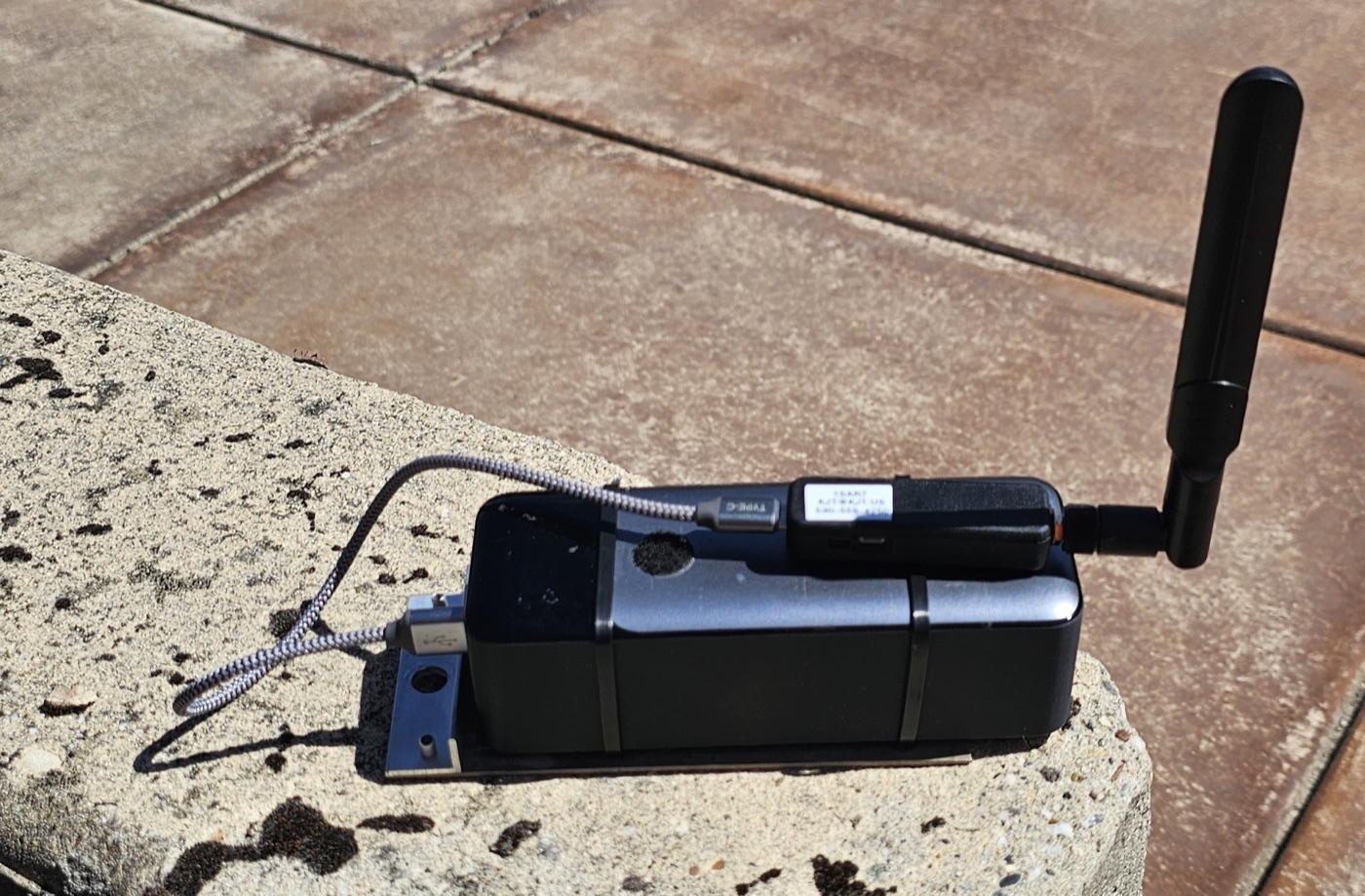
A DroneScout Bridge can receive Remote ID broadcasts over thousands of feet when terrain, line of sight, and radio conditions cooperate.
DS100 details and purchase optionsSTEP 03
RID2Caltopo records tracks locally and directly to incident maps.
STEP 04
Stream video locally from a drone to a tablet to engage squinters in reviewing the live feed.
A clear capability boundary
RID2Caltopo and a DroneScout Bridge provide the core field tools. An optional r2c-tracker service adds cross-device coordination and server-side services.
Install the app, deploy a DroneScout Bridge for reliable Remote ID reception, and connect directly to your incident map.
During beta testing, each organization receives a generous platform-funded usage allowance. An expanding list of features includes:
Bring nearby flight restrictions, operational airspace context, and protected-land checks into the incident workflow with visible freshness and availability status.
Coordinate multiple RID2Caltopo tablets and DroneScout Bridges, assign drone ownership, relay sightings, and suppress duplicate tracks.
Retain an organization-wide record of flights that document pilot, drone, distance, time, and weather information to record incident and training flights and support FAA waiver compliance.
Let authorized IC personnel request a live drone feed. Video leaves the field tablet only after the pilot approves the connection.
Record retention supports an organization's documentation; operators remain responsible for their authorization, procedures, and applicable FAA requirements. FAA BVLOS information
Choose your path
The app and Bridge can work directly with . Teams that need distributed coordination can learn about the r2c-tracker service, host it themselves, or join the managed pilot.
Use the mobile app locally, publish directly to , or deploy and administer your own open-source tracker.
A cost-sharing pilot for volunteer organizations that want compliance awareness and incident-wide coordination without administering cloud infrastructure.
The managed service is an open-ended beta with no fixed end date, and R2C Tracker does not accept payments. Site administrators can monitor their team's attributed usage and decide who may request streams and when, based on the organization's priorities.
Learn in the field
Start with the DroneScout Bridge field setup, then configure your team drones and account. Next, connect a controller video stream for squinter-assisted clue searching, then continue with advanced Mutual Aid package preparation. Managed organizations can also follow the site-administration guide for activation, policy, roles, enrollment, usage oversight, and records.
3 min • Field setup
Enable Relay ping, place the Bridge for useful line of sight, and verify power and live Remote ID reception before operations.
Watch or download video6 min • Configuration
Create a tracking Access URL and Connect Key, add your organization’s drones and API tuple, verify Shared Locations and a team map, and protect ORG access with the device screen lock.
Watch or download video5 min • Field video
Give a squinter a larger live view, bind video to Remote ID telemetry with the drone designator, and submit picture waypoints to the incident map.
Watch or download video5 min • Advanced Mutual Aid
Prepare early, cache the operational map, set the expiration, and transfer locally by peer-to-peer wireless or a USB-C storage device to minimize Starlink and cellular traffic.
Watch or download video5 min • Site administration
Activate a new site administrator, set privacy and retention, monitor service status, delegate member roles, enroll field devices, and manage flight records.
Watch or download videoField testers wanted
We’re looking for SAR drone teams, pilots, communications specialists, and technically curious volunteers willing to test real equipment and report what happens.
Looking ahead
Roadmap items are research directions, not release commitments. Operational decisions must always be based on verified information, trained personnel, and applicable procedures.